← Home · Foundations

Shallow Foundation Design in Bangor: Ground Conditions That Shape the Decision

Together, we solve the challenges of tomorrow.

READ MORE →

Bangor sits where the mountains meet the Menai Strait. Elevation shifts from sea level to over 100 metres in less than a mile. That means one thing for shallow foundation design: ground conditions change fast. A site on the High Street can sit on glacial till while a plot 300 metres east hits weathered schist. In our experience, the biggest mistake we see is assuming uniform bearing strata. It rarely happens here. The Ordnance Survey pinpoints Bangor at 53.2277, -4.1269, but the geology underneath that point tells a more complicated story. Getting the bearing pressure right early saves redesign costs later. We pair our shallow foundation design with test pits to verify the top 3–4 metres where footings will sit. Without that visual check, even a tight SI can miss soft pockets left by glacial meltwater channels common across Gwynedd.

In Bangor, the difference between a straightforward strip footing and an expensive ground replacement often comes down to one metre of glacial clay.
Shallow Foundation Design in Bangor: Ground Conditions That Shape the Decision
Technical reference image — Bangor

Regional considerations

Glacial till dominates Bangor. It sounds uniform. It is not. The Irish Sea ice sheet left a mix of stiff clay, sand lenses, and cobbles. Depth to rock varies from less than a metre near College Road to over 15 metres in the lower Hirael area. What catches people out is the water. Perched groundwater sits in sandy layers within the till. Excavate a footing in January and you might hit a lens that was dry in August. We have seen sites where the bearing capacity dropped by 40% simply because the season changed. A shallow foundation design that ignores perched water is gambling. We combine our design work with in-situ permeability testing when the borehole log shows interbedded silts and sands. The second risk is made ground. Bangor’s waterfront expanded over old tidal flats. Those fills contain anything from quarry waste to Victorian rubble. Uncontrolled fill means differential settlement. Our approach is pragmatic. Identify it. Remove it. Or design the footing to bridge it. No shortcuts.

Need a geotechnical assessment?

Reply within 24h.

Email: contact@geotechnical-engineering.biz

Reference parameters


ParameterTypical value
Typical bearing strata in BangorGlacial till, weathered Ordovician schist, alluvial gravels near Strait
Design standardBS EN 1997-1:2004 (Eurocode 7) with UK National Annex
Common footing typeReinforced strip and pad footings at 0.9–1.5 m depth
Bearing capacity range (till)150–250 kPa (allowable, SLS)
Groundwater considerationPerched water in glacial deposits; tidal influence near shoreline
Settlement trigger depthInfluence zone typically 2x footing width; critical in interbedded silts
Sulphate class checkRequired per BRE Special Digest 1 for concrete specification

Associated technical services

01

Bearing capacity and settlement analysis

We calculate ultimate and allowable bearing pressures per Annex D of Eurocode 7. Settlement is assessed using the Schmertmann method for granular soils and oedometer-based consolidation for cohesive layers. Every report includes a clear statement of the design bearing pressure and the expected total settlement under working loads.

02

Foundation type recommendation and detailing

Based on the ground model we recommend strip, pad, or trench-fill footings. We specify depth, width, reinforcement, and concrete class. If sulphate attack is a risk, we define the Design Sulphate Class and the corresponding ACEC classification per BRE SD1 so the structural engineer has a complete spec.

Standards that apply


BS EN 1997-1:2004 (Eurocode 7: Geotechnical design), BS 5930:2015 (Code of practice for ground investigations), BS 8004:2015 (Code of practice for foundations), BRE Special Digest 1 (Concrete in aggressive ground)

Q&A

How much does a shallow foundation design package cost for a typical Bangor residential extension?

For a single-storey extension on a standard Bangor plot, our design package generally ranges from £1,450 to £2,530. The final figure depends on whether we need to commission new test pits or can work from existing site investigation data, and how complex the ground profile turns out to be.

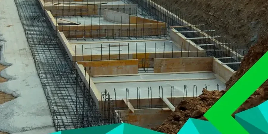
What ground investigation is needed before you can design the footings?

We need at least two exploratory points to 3 metres depth for a house extension. Usually that means machine-dug test pits or window sampler boreholes. If the site is on a slope or near the Strait, we may add a third point to capture the variation. Lab testing on disturbed and undisturbed samples follows. Without this data, any design is guesswork. BS 5930 gives the framework we follow.

How long does the design process take from site visit to final report?

Site work takes one day. Lab testing runs five to seven working days. The design and reporting phase takes another week. In total, expect two to three weeks from instruction to final issue. We can fast-track to ten working days if the structural engineer is waiting to start detailing.

Location and service area

We serve projects across Bangor and surrounding areas.

View larger map