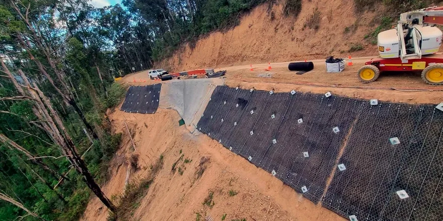
Bangor sits at 53.2277°N on the Menai Strait, where the geology shifts abruptly from Ordovician slate to glacial till and alluvial deposits. A 2023 planning application for a hillside extension near Penrhosgarnedd was refused after the Phase 1 desk study missed a rotational failure plane in weathered mudstone. That scenario plays out more often than it should. Our test pits programme maps the residual soil profile across the site, while triaxial testing yields the effective stress parameters needed for a BS EN 1997-1 Design Approach 1 analysis. For the steep coastal bluffs east of the pier, we integrate seismic refraction to define bedrock geometry before any limit equilibrium modelling begins. The output is a slope stability report that Bangor planning officers and building control surveyors can review without follow-up queries.
A slope stability factor of safety below 1.3 in Bangor's glacial till demands either reinforcement design or a drainage scheme before the planning submission.
Standards that apply
BS EN 1997-1:2004 + UK National Annex (Eurocode 7: Geotechnical design), BS 5930:2015 + A1:2020 (Code of practice for ground investigations), BS EN 1998-5:2004 (Eurocode 8: Seismic design – foundations, retaining structures), CIRIA C580 (Embedded retaining walls – guidance for economic design), Highways England CD 622 (Managing geotechnical risk)
Q&A
What is the typical cost range for a slope stability analysis in Bangor?
For a single residential plot in Bangor, the analysis and report typically fall between £1,140 and £3,490 depending on the number of soil units, the groundwater complexity, and whether seismic loading is required. Sites with tidal influence or multiple cross-sections run at the upper end.
How long does a slope stability assessment take from instruction to final report?
The site work—trial pits, CPTs, sampling—takes two to three days. Laboratory testing runs two to three weeks for triaxial effective-stress suites. Modelling, reporting, and QA review add another week. A realistic timeline is four to five weeks.
Does a slope stability report satisfy Bangor building control requirements?
Yes, provided it follows BS EN 1997-1 Design Approach 1 with the UK National Annex. We include the Designers' Risk Assessment and a clear statement of the geotechnical category so building control can sign off without requesting supplementary information.
What soil parameters do you use for Bangor's glacial till?
We derive c' and φ' from consolidated-undrained triaxial tests with pore-pressure measurement on Shelby-tube samples. The till in the Bangor area typically shows c' = 2–8 kPa and φ' = 28–34°, with the lower values corresponding to the weathered matrix-rich facies. These are site-specific and never taken from generic tables.
How do you handle the tidal groundwater along the Menai Strait?
We install standpipe piezometers and log water levels over a full spring–neap tidal cycle. The data feeds a transient seepage model that captures the lag between tide level and pore pressure in the slope. The rapid-drawdown case is run with the lowest low-water spring tide as the downstream boundary.